Showing posts with label maps. Show all posts

Tuesday, December 05, 2017

Other sessions from LMCC 2017

Space Study: 

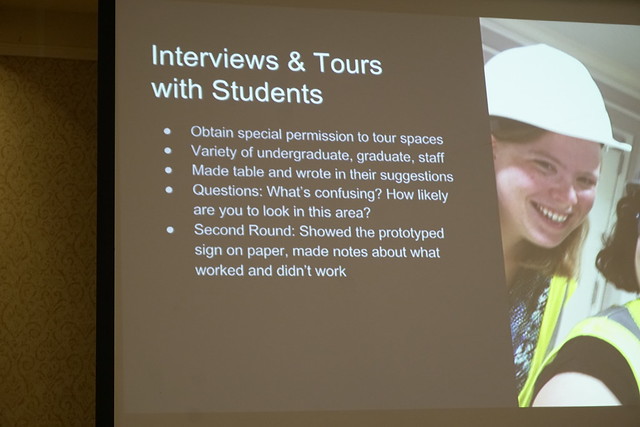
Akron University Library survey's the in building users simple coded paper survey, delivered by library student employees who they pretrained to deliver the survey. Surveys were returned to a drop box near the exit doors.
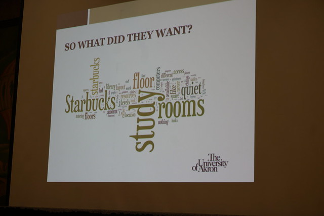
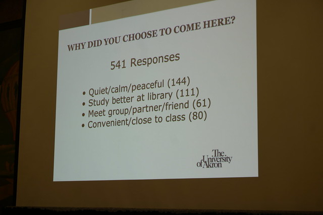
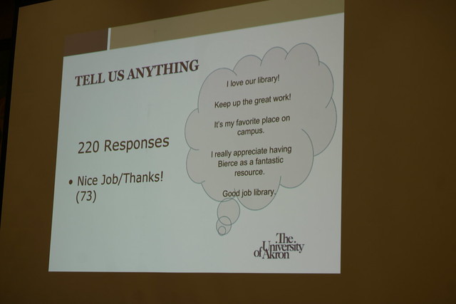
Results    _JLS1796

_JLS1800

_JLS1802

Used the survey to change things, refreshed study rooms, added comfy bean bag chairs, udpated charging stations, scientific calculators for checkout, mobile whiteboards. Also updated signage on quiet floor.

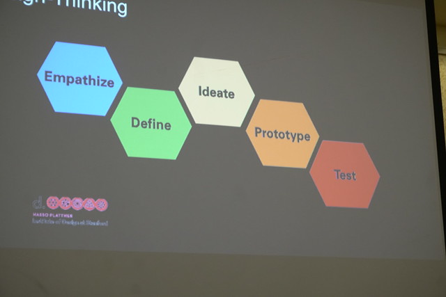
Human Centered Design for Building Signage

_JLS1870

_JLS1879

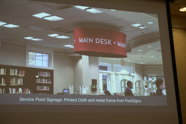
Library Lingo is not User Friendly Single service point titled "Central Services Desk" changed to
"Main Desk" _JLS1886

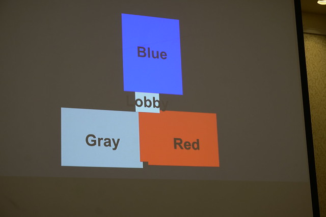
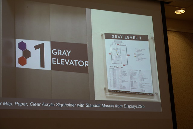
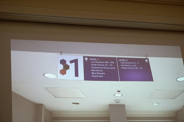
"Design is the silent ambassador of your brand" - Paul Rand Comprehensive design applied to signage at the Fondren Library: The building in color identified sectors
_JLS1890

Elevator wrap with wayfinding floor map _JLS1893

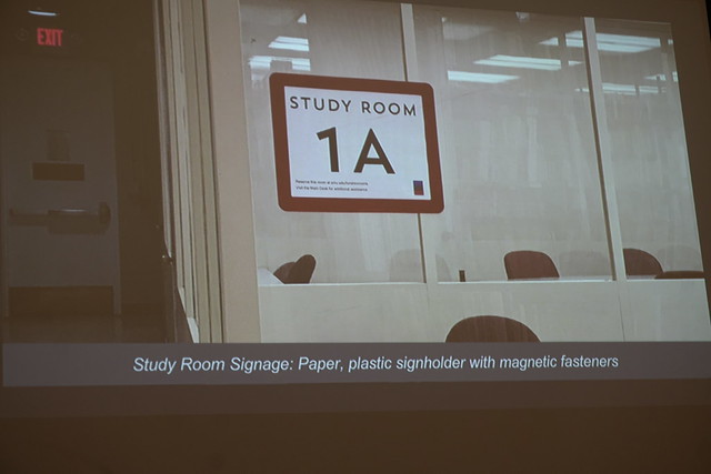
Color scheme applies to study rooms in specific buildings
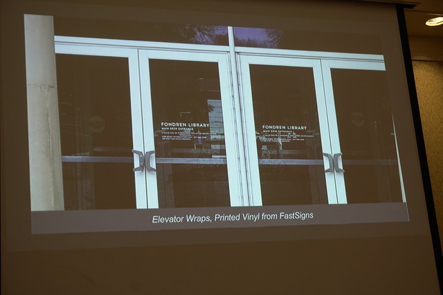
 _JLS1900

Front door vinyl _JLS1904

On color wall _JLS1906

Used Hexagon to match floor and desks More wayfinding _JLS1913

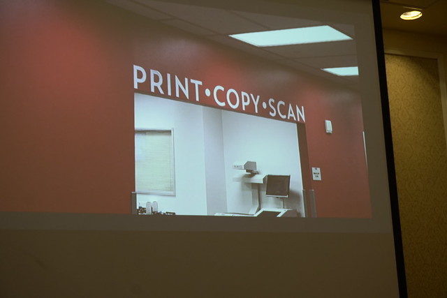
More signage used across buildings _JLS1914

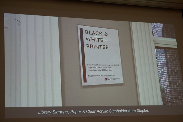
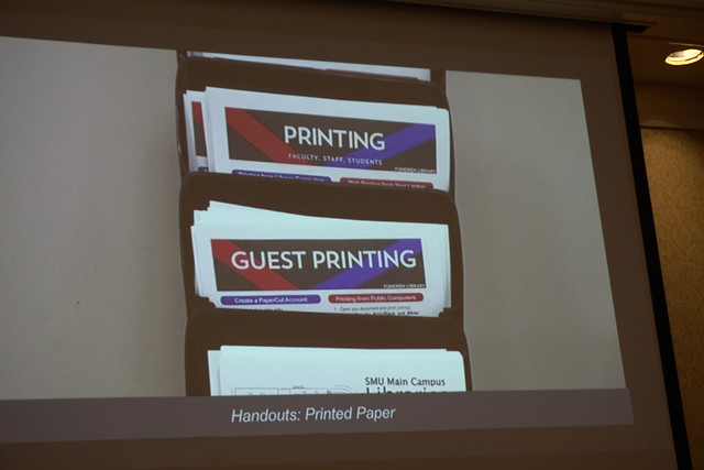
Handouts to match signage _JLS1915

Walk through the building to find out how your signage works. Another wayfinding _JLS1920

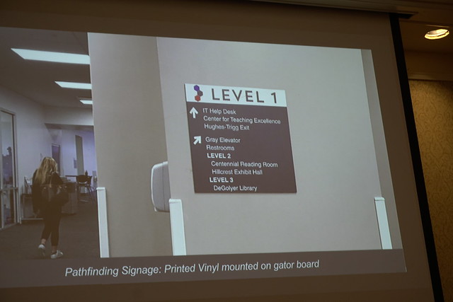
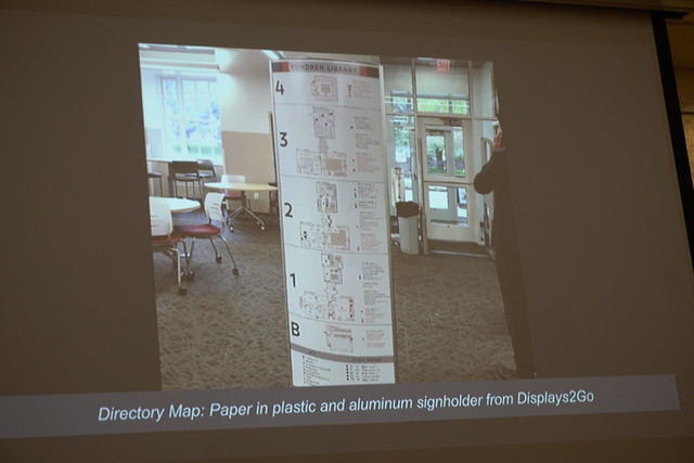
A comprehensive directory near the entrance _JLS1922

Always do a print test of font size and color
Less words = more likely to be read/used

Resources 
Useful, Usable, Desirable by Aaron Schmidt and Amanda Etches
Service Innovation Handbook by Lucy Kimball
UX for the Masses website
Usability.gov 
Guerilla UX Research Methods by Russ Unger and Todd Zaki Warfel
Don't Make Me Think by Steve Krug
Rocket Surgery Made Easy by Steve Krug


Tuesday, July 07, 2009

Clark County Public Library - Nevada

Large laminated map of vicinity...

nevada map

Thursday, September 11, 2008

What is a map and what does it really represent?


Check out the article "Internet maps 'demolish British history'". I found it interesting to think beyond the idea of a map as a way to get to a specific destination or to find out specific information. The writer of the article clearly thinks that maps give a sense of place and character. That they are cultural artifacts.

In the library world we have always had a multitude of maps and atlases with multiple, varied, and unique purposes. Street maps, cultural maps, political maps, historical maps, maps of stars, maps of commerce and farming, maps of all kinds of information. These varied maps usually come bound in atlases and are there for us when we need specific kinds of information like a map of the Battle of Hastings or the locations of all of the castles in Scotland. I use them to help patrons find information. I have never really thought about how they are also cultural artifacts tied not only to a specific place but to a time.

I have always used Mapquest or Google-Maps to find a specific address, I've never thought of using them as guides or tourbooks. Cultural features can be found on other map forms. When traveling I tend to use Mapquest to find specific destinations AND a guidebook to see what else is around. I use the Internet to find interesting and unusual things to go and see on the way. On my sabbatical I used the National Park Service site to find National Parks, Monuments and Historic places.

I'm an information omnivore with a Masters in Library Science, which pretty much gives me a black belt in finding information. So what about John Q. Public. Are they masters of travel information? Should Google-Maps and Mapquest be putting more cultural information on their road maps in order to function more like a sightseeing guide? According to the article, Google-Maps does have the ability to show these
features, but how many people turn that on? I think I have more questions than answers. It is hard to ascertain peoples information seeking behavior on travel using the internet.

I have another question to add. Do the GPS guidance systems in automobiles like "Tom Tom" give cultural information or just guidance to a specific address? Since I don't own one of these I do not have the answer, nor a deep enough interest in this question to go find out...

This is a small sample of the scope of the atlas collection in the Oboler Library Reference Area:

Atlas of the breeding birds of Nevada
REF: QL684.N3 A85 2007

Atlas of the world’s languages
REF: G1046.E3 A8 2007

Idaho atlas & gazetteer
REFDESK: G1480 .I33 2007

An atlas of poverty in America
REF: HC110.P6 G543 2006

Atlas of North America
REF: G1105 .A8 2005

Atlas of the world
Atlas Stand: G1021 .G4125 2005

America discovered : a historical atlas of North American exploration
REF: G1106.S12 H3 2004
Idaho Falls Reference: G1106.S12 H3 2004